In Auravant you now have a great diversity of information layers to load. That is why we decided to group them according to the type of data that applies to each one.
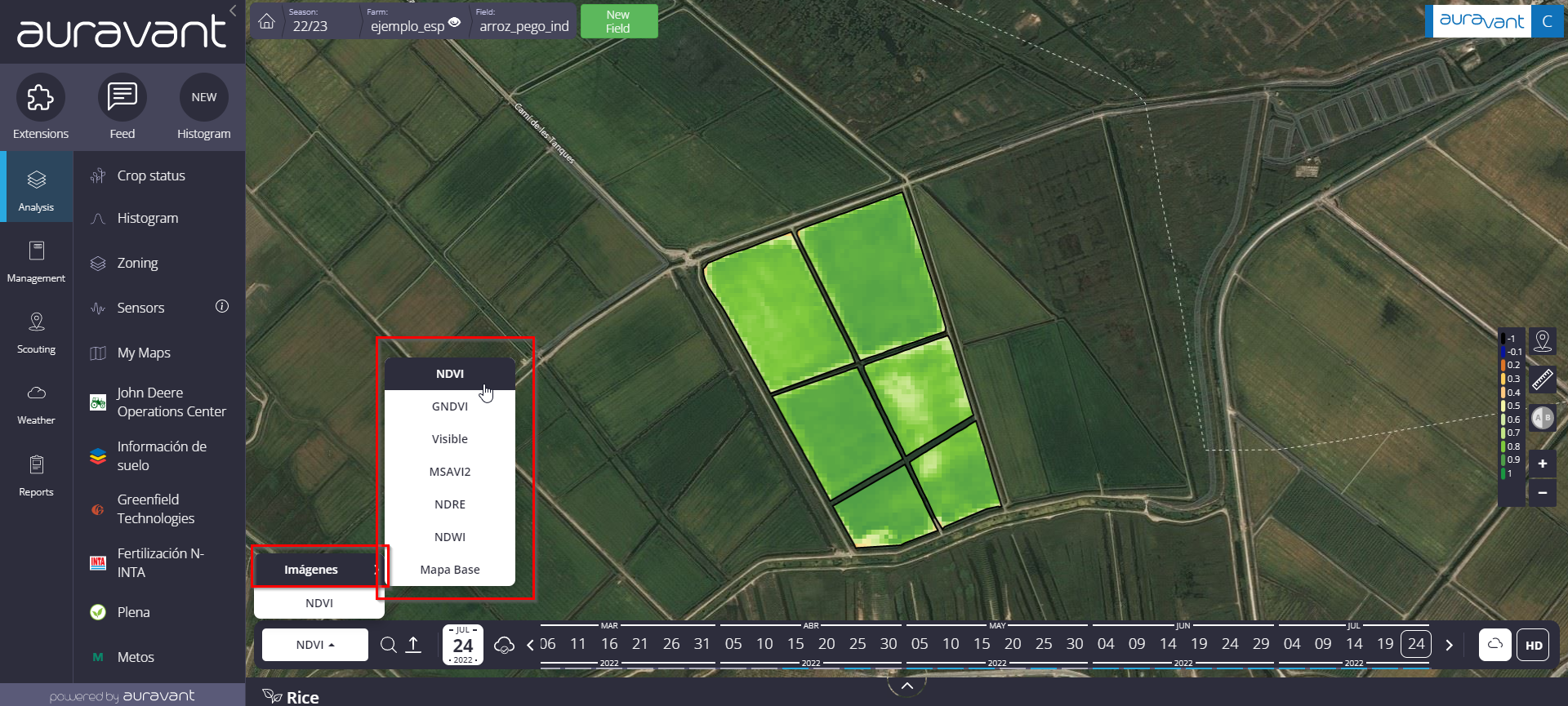
Within the Images category, you will see the following satellite image options:
NDVI: Normalized Difference Vegetation Index.
GNDVI: Green Normalized Difference Vegetation Index
MSAVI2: Modified Soil Adjusted Vegetation Index
NDRE: Normalized Difference Red Edge Index
Visible: Raw satellite image (RGB)
Base Map: Bing Aerial with labels.
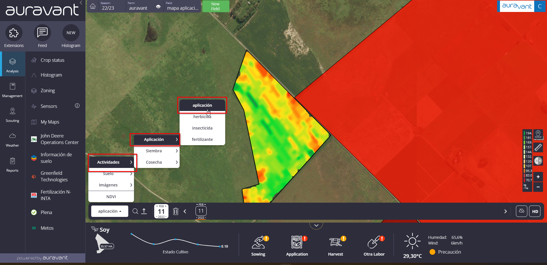
Within the category of activities, load the following work options:
Sowing: you will be able to add the following variables: Rate, Forward Speed, Variety.
Application: you will be able to add the following variables: Rate, Forward Speed, Pressure, Temperature, Humidity.
Harvest: Yield, Humidity, Forward Speed.
Other labor
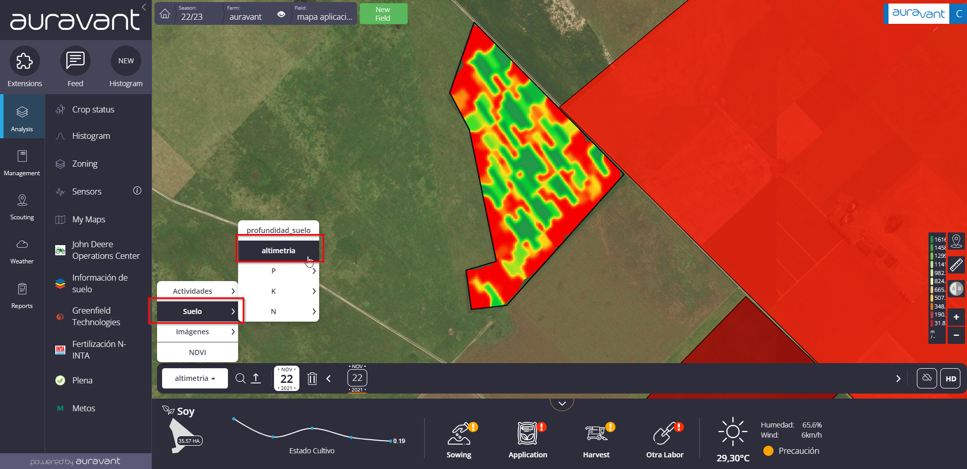
By using the “Elevation” data of the harvester, the altimetry of the field is recorded. From the “Soil” section you can load it as an information layer that will be useful to know the terrain of your field.
Within the soil category, you can load the following maps:
MO
N
P
K
S
PH
Ca
Mg
Na
Electroconductivity
Sand
Clay
Silt
Density
Altimetry
Depth
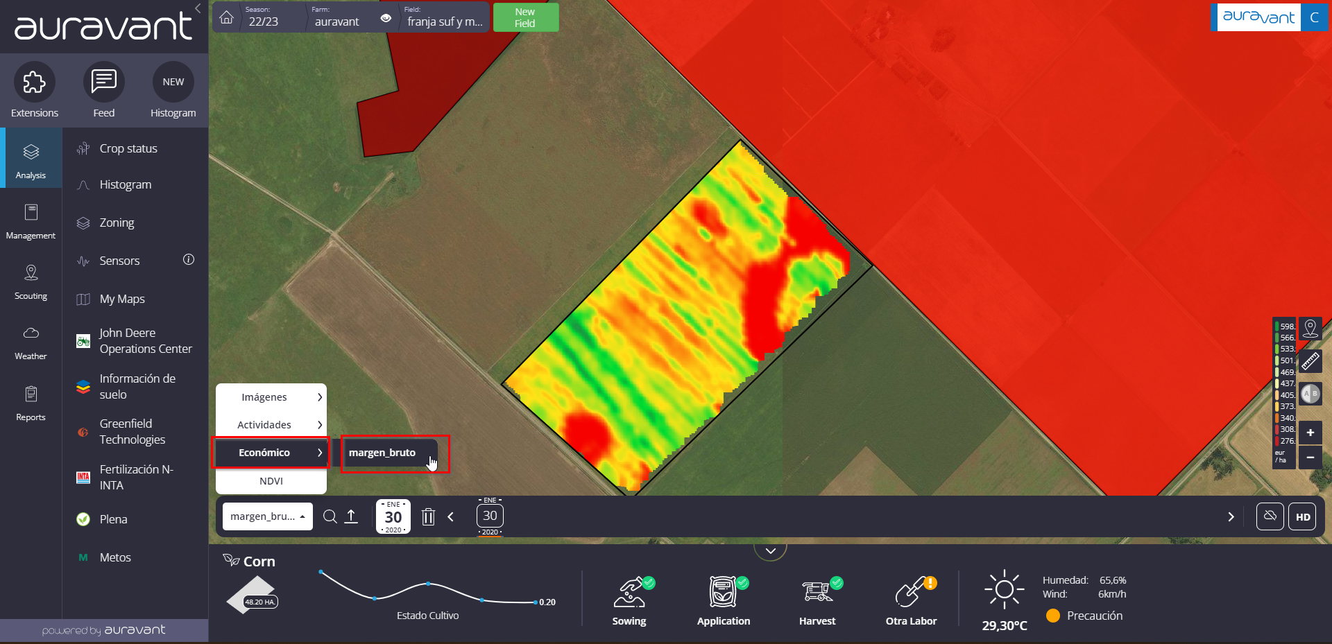
Within the category of Economical Insights, you will be able to load the following maps:
Cost
Income
Gross Margin
“