To create an equation across multiple fields, the procedure is the same as when working at the individual field level, but with the advantage of being able to apply the same calculation logic over several areas simultaneously. This allows you to save time and maintain consistent technical criteria across different production zones.
Equations are built by combining mathematical functions, logical functions (conditionals such as if/else), and layers (satellite imagery, sampling maps, NDVI, soil data, etc.), along with constants defined by the user (for example, fixed input rates).
This approach allows you to integrate information from multiple sources to generate consistent maps and prescriptions without having to repeat the process field by field.
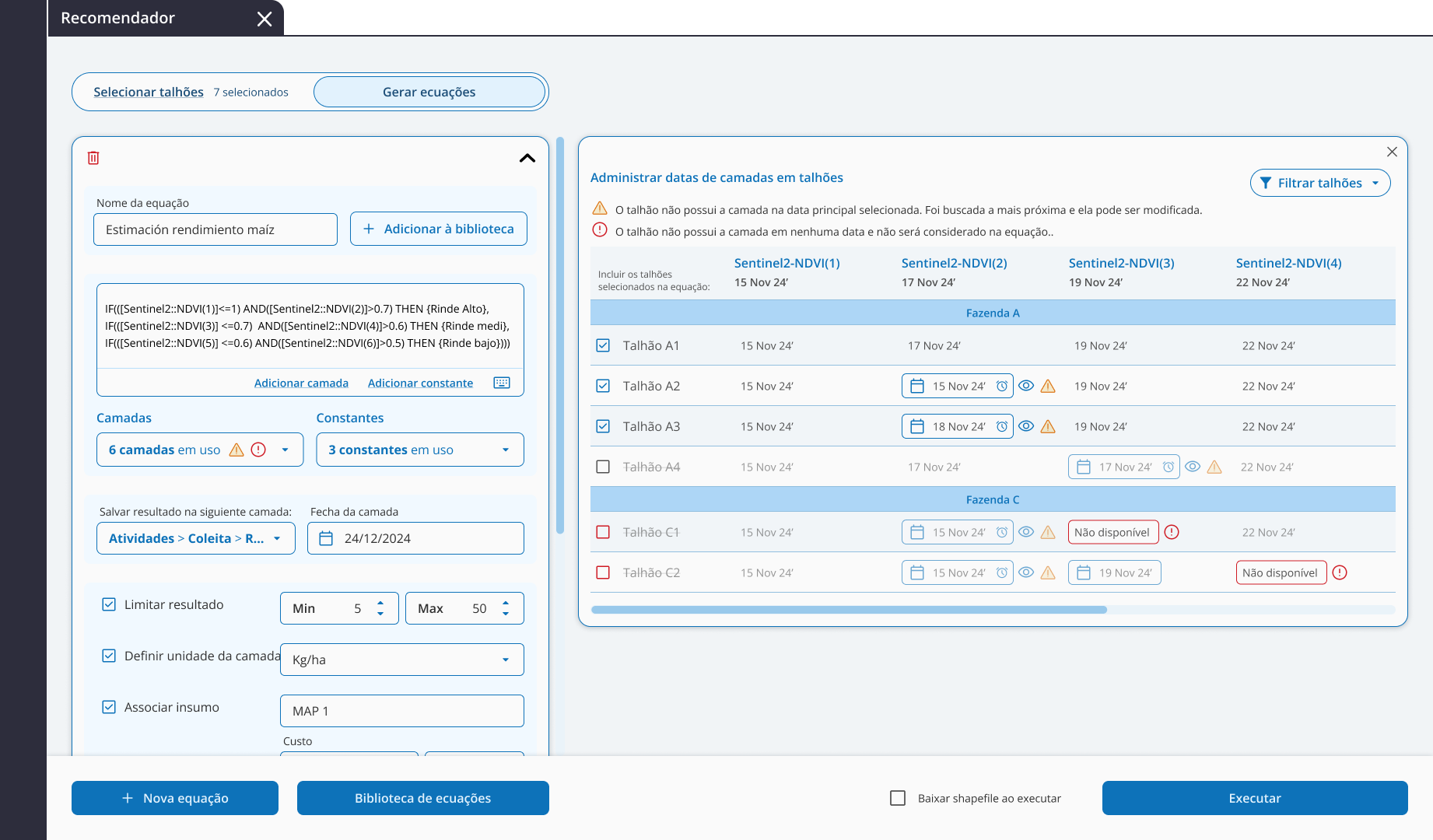
- It will indicate how many layers are being used.
- If a field doesn’t have the selected layer date, a warning icon will appear:
- If there’s no available version of the layer, that field will not be included in the calculation.
- If a nearby date exists, it can be manually selected.

From the Date Manager you can view the list of fields and adjust dates if needed. Fields without available layers will appear in red and be excluded from the process.
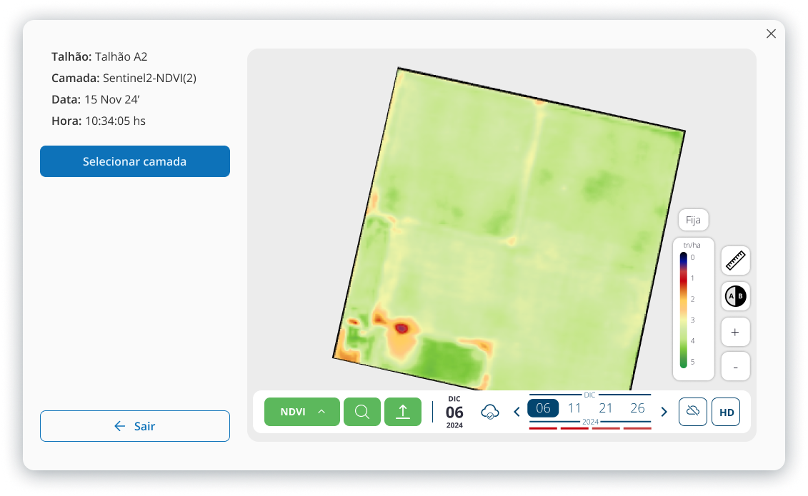
TIP: By clicking on the eye icon, you can preview the proposed layer.
Once the equation is completed and the layer is assigned, it can be executed and downloaded. The process may take a few minutes, and you’ll be notified once it’s ready through the notification center.
| Other articles you may find useful: |
Interested in trying Auravant? Create your free account.
If you’d like, visit our YouTube channel to watch our videos, or explore our Help Center for more information.